City | River
Taylor Massey Creek flows through Scarborough and East York, then merges into the Don River.
The Creek is one of the most contaminated waterways in Canada. Its adjacent wetlands are gone. Some of it now runs in underground pipes. Much of its wildlife has disappeared.
For eight years a group of volunteers and 41 partner organizations have been working to fix this.
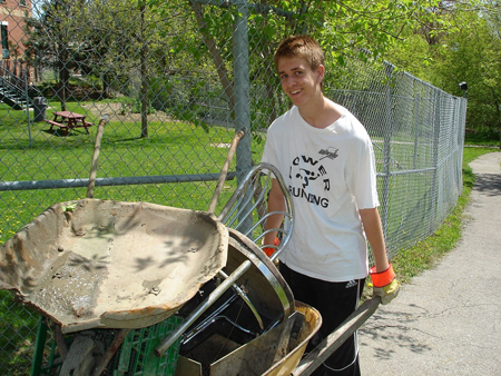
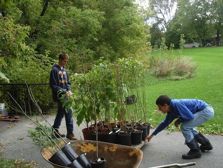
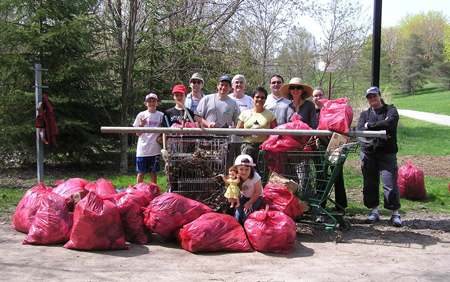
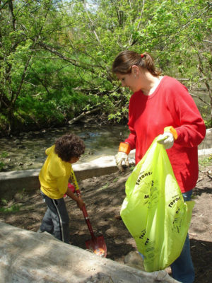
They call themselves The Taylor Massey Project, and they have staged 79 public events, planted 4,382 trees and shrubs, collected 1,610 bags of litter from local ravines, and made more than 30 submissions to government agencies.
The aim is to restore the natural heritage of Creek valley-lands, to improve the water quality and aquatic habitats, and to create a Taylor Massey Trail along the whole of the Creek.
The Taylor Massey Project is lively urban activism.
Where is Taylor Massey Creek?
Taylor Massey Creek is the smallest of the three main tributaries of the Don River.
It flows from near Highway 401 and Pharmacy Road approximately 16 kilometres to the Forks of the Don near Pottery Road and the Don Valley Parkway.
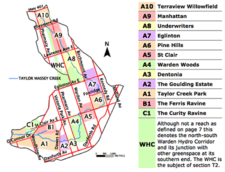
The blue line on the Reach Map shows the Creek. Also shown in the shaded areas are its main “reaches”, or sections, as well as the Warden Hydro Corridor, which could be turned into much-needed parkland and trail.
You can see more detailed versions of the Reach Maps at the Reach Portal on the Taylor Massey Project website.
A Legacy of Injury
Taylor Massey Creek suffers from numerous and long-standing urban abuses.
Historically-clean headwaters flowing from north of Highway 401 were diverted during construction of the highway.
As a result, the 18 hectares of Highway 401 that form the current headwaters deliver huge volumes of litter, cigarette butts, dripped automobile fluids, bits of rubber from tires, and flashes of winter salt downstream.
Only one of the Creek’s 2,859 hectares was retained as wetland.
A third of the Creek has been placed in concrete channels, rubbing up against buildings rather than hosting parks and wildlife. A whole section, between Manhattan and Lawrence, was placed underground. And the Creek has only one stormwater pond, installed about 15 years ago.
As a result, run-off is not treated for either quantity or quality, and the volume of run-off entering the Creek creates high peak flows that cause erosion downstream and ruin spawning areas.
Worse, some of its small tributaries now run in underground pipes, many in “combined sewers” that release human waste to the Creek during high flows.
Overall water quality in Taylor Massey is extremely poor. While the Creek only contributes 5% to the overall flow of the Don River, under certain conditions it contributes up to 80% of the Don River’s pollution.
Warden Woods
Warden Woods is one of the ecological jewels of Taylor Massey Creek. It consists for the most part of a well-treed flood-plain and steep valley slopes that shelter the creek as it flows from St Clair and Warden south to Pharmacy Avenue.
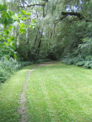
A short way in from either of its two uninviting main entrances, and in spite of the occasional rumblings of the subway that passes through a section of the park, Warden Woods becomes quiet, picturesque, and a host to dynamic populations of trees and birds. Good soils support a relatively large forest with many areas of mature trees and intact understory growth.
However, the long-term ecological integrity of Warden Woods is threatened by several modern realities, including extensive stream-bank erosion, invasive species, and poor lot management practices.
Ecological Awakenings
Following the near-collapse of the Lake Erie fishery around 1970, a Canada-U.S. agreement called for “the restoration and maintenance of the chemical, biological, and physical properties of the Great Lakes” – including Lake Ontario and the waterways that feed it.
Today, ideas like natural heritage protection, watershed management, pollution prevention and green infrastructure are increasingly understood, and are finding support in the political arena.
Locally, the City of Toronto has adopted tree and ravine by-laws, a sewer use by-law, and a by-law banning the cosmetic use of dangerous pesticides.
And Toronto is developing a 25-year, billion-dollar Wet Weather Flow Master Plan that will do two things. It will increase the capacity of sanitary sewers. And it will eliminate what are called “combined sewer overflows” that now put human waste into our creeks.
Water quality in Taylor Massey Creek, home to ten of Toronto’s combined sewers, should be significantly improved.
Terraview-Willowfield
Originally consisting of about 150 hectares above Highway 401, Taylor Massey Creek’s headwaters now consist of about 18 hectares, including polluted run-off from the 401 and underground springs. This flow is collected into pipes and emerges at Terraview-Willowfield, named for two schools in the area.
Past regeneration efforts costing about $1.5 million removed the creek from its concrete channel, installed an experimental treatment pond, and established two natural ponds and a pedestrian trail, with a splash pad and a ball diamond near Willowfield School. The ball diamond was put in on top of the fill excavated for the ponds, saving transport and landfill costs and creating a sound barrier against Highway 401.
Connecting the Community
Taylor Massey Creek does not have a walkable trail along its length.
A good trail does exist at the lower end, south from Warden Woods to where the Creek meets the Don River. But north of Warden Woods there are only disconnected sections of informal footpaths. They could easily be connected. All it would take is two traffic lights, two pedestrian bridges over the Creek, two safe passages over or under railway tracks, and some signage.
In addition, if Toronto acquired the Warden Hydro Corridor from the province it would add an important link to the trail, enabling people to get around the section of the creek that runs on private property between Ellesmere and Lawrence. It would also add greatly-needed greenspace to this section of Toronto, which could include as many as 200,000 trees and shrubs and both a pedestrian trail and a cycling path.
The Taylor Massey Project estimates that for about a million dollars, Toronto could enhance a revitalized watercourse with a continuous 16-kilometre Taylor Massey Trail, running from just south of Highway 401 to the junction of the Creek with the Don.
This would increase local outdoor recreation opportunities, increase the local forest canopy, link local communities, and provide a connection to trails that already extend to Lake Ontario.
|
|
Curated by:
Max Allen


